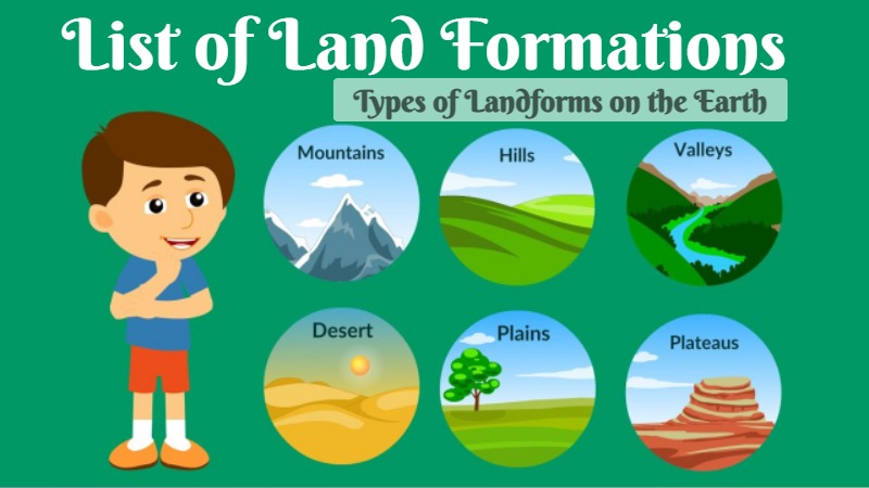
Land Formations list in alphabetical order, check all types of landforms found on the earth. Landforms are the natural features or shapes that occur on the Earth’s surface. They are the result of various geological processes such as erosion, deposition, tectonic activity, and weathering over millions of years. Landforms can be found on continents, in oceans, and even on other celestial bodies like the moon and Mars. Some common types of landforms includes mountains, plateaus, valleys, plains, cape, cliff, hills, desert, dune, marsh, among others.
Land formations are also known as geological formations or geological features, refer to specific types of landforms that share common characteristics. The land formations are often named based on their distinct appearance, composition, or geological history. These formations can be found within larger landforms or as standalone features. Here is a list of various land formations found on Earth:
Land Formations List (A-Z)
- Abîme – Geographical term referring to vertical shaft in caves
- Abyssal fan – Underwater geological structures associated with large-scale sediment deposition
- Abyssal plain – Flat area on the deep ocean floor
- Ait – Islands found on the River Thames and its tributaries in England
- Alluvial fan – Fan-shaped deposit of sediment
- Anabranch – A section of a river or stream that diverts from the main channel and rejoins it downstream.
- Arch – Arch-shaped natural rock formation
- Archipelago – Collection of islands or a group or chain of islands.
- Arête – Narrow ridge of rock which separates two valleys
- Arroyo – Dry watercourse with flow after rain
- Atoll – Ring-shaped coral reef
- Ayre – Shingle beaches in Orkney and Shetland
- Badlands – Type of heavily eroded terrain
- Bajada – compound Alluvial fan
- Bar – Natural submerged sandbank that rises from a body of water to near the surface
- Barchan – Crescent-shaped dune
- Barrier bar – Natural submerged sandbank that rises from a body of water to near the surface
- Barrier island – Coastal dune landform that forms by wave and tidal action parallel to the mainland coast
- Bay – Recessed, coastal body of water connected to an ocean or lake
- Baymouth bar – Sandbank that partially or completely closes access to a bay
- Bayou – French term for a body of water typically found in flat, low-lying area
- Beach – Area of loose particles at the edge of the sea or other body of water
- Beach cusps – Shoreline formations made up of various grades of sediment in an arc pattern
- Beach ridge – Wave-swept or wave-deposited ridge running parallel to a shoreline
- Bench – Long, relatively narrow land bounded by distinctly steeper slopes above and below
- Bight – Shallowly concave bend or curve in a coastline, river, or other geographical feature
- Blowhole – Hole at the top of a sea-cave which allows waves to force water or spray out of the hole
- Blowout – Depressions in a sand dune ecosystem caused by the removal of sediments by wind
- Bluff – Tall, near vertical rock face
- Bornhardt – A large dome-shaped, steep-sided, bald rock
- Braided channel – Network of river channels separated by small, and often temporary, islands
- Butte – Isolated hill with steep, often vertical sides and a small, relatively flat top
- Calanque – Narrow, steep-walled inlet on the Mediterranean coast
- Caldera – Cauldron-like volcanic feature formed by the emptying of a magma chamber
- Canyon – Deep ravine between cliffs. A deep, narrow valley with steep sides, often carved by a river.
- Cape – Large headland extending into a body of water, usually the sea. A pointed piece of land that extends into a body of water, usually smaller than a peninsula.
- Carolina bay – Elliptical depressions concentrated along the Atlantic seaboard of North America
- Cave – Natural underground space large enough for a human to enter
- Cenote – Natural pit or sinkhole that exposes groundwater underneath
- Channel – Type of landform in which part of a body of water is confined to a relatively narrow but long region
- Cirque – An amphitheatre-like valley formed by glacial erosion
- Corrie – An amphitheatre-like valley formed by glacial erosion or cwm
- Cliff – Tall, near vertical rock face. A vertical or nearly vertical rock face or slope.
- Coast – Area where land meets the sea or ocean
- Col – Lowest point on a mountain ridge between two peaks
- Complex crater – Large impact craters with uplifted centres
- Complex volcano – Landform of more than one related volcanic centre
- Confluence – Meeting of two or more bodies of flowing water
- Continental shelf – Coastal and oceanic landform
- Coral reef – Outcrop of rock in the sea formed by the growth and deposit of stony coral skeletons
- Cove – Small sheltered bay or coastal inlet
- Cove (mountain) – Small valley in the Appalachian Mountains between two ridge lines
- Crevasse splay – Sediment deposited on a floodplain by a stream which breaks its levees
- Crevasse – A deep crack, or fracture, in an ice sheet or glacier
- Cryovolcano – Type of volcano that erupts volatiles such as water, ammonia or methane, instead of molten rock
- Cuesta – Hill or ridge with a gentle slope on one side and a steep slope on the other
- Cuspate foreland – Geographical features found on coastlines and lakeshores
- Cut bank – Outside bank of a water channel, which is continually undergoing erosion
- Dale – Low area between hills, often with a river running through it
- Defile – Narrow pass or gorge between mountains or hills
- Dell – Small secluded hollow
- Delta, River – Silt deposition landform at the mouth of a river. A landform created at the mouth of a river, where it enters a larger body of water, and deposits sediment to form a triangular or fan-shaped area.
- Desert pavement – Type of desert earth surface. It is a barren area with little or no vegetation, typically receiving very little rainfall.
- Diatreme – Volcanic pipe associated with a gaseous explosion
- Dike – A sheet of rock that is formed in a fracture of a pre-existing rock body
- Dirt cone – Depositional glacial feature of ice or snow with an insulating layer of dirt
- Dissected plateau – Plateaus area that has been severely eroded so that the relief is sharp
- Doab – Land between two converging, or confluent, rivers
- Doline – Geologically-formed topological depression
- Dome – Geological deformation structure
- Drainage basin – Area of land where precipitation collects and drains off into a common outlet
- Drainage divide – Elevated terrain that separates neighbouring drainage basins
- Draw – Terrain feature formed by two parallel ridges or spurs with low ground in between
- Drumlin – Elongated hill formed by glacial action
- Dry lake – Basin or depression that formerly contained a standing surface water body
- Dune – Hill of loose sand built by aeolian processes or the flow of water. A hill of sand formed by wind or water action.
- Dune system – Hill of loose sand built by aeolian processes or the flow of water
- Ejecta blanket – Symmetrical apron of ejecta that surrounds an impact crater
- Endorheic basin – Closed drainage basin that allows no outflow
- Erg – Broad area of desert covered with wind-swept sand
- Escarpment – Steep slope or cliff separating two relatively level regions (scarp)
- Esker – Long, winding ridge of stratified sand and gravel associated with former glaciers
- Estuary – Partially enclosed coastal body of brackish water
- Exhumed river channel – Ridge of sandstone that remains when the softer flood plain mudstone is eroded away
- Faceted spur – Ridge that descends towards a valley floor or coastline that is cut short
- Fault scarp – Small vertical offset on the ground surface
- Firth – Scottish word used for various coastal inlets and straits
- Fissure vent – Linear volcanic vent through which lava erupts
- Fjard – Glacially formed, broad, shallow inlet
- Fjord – Long, narrow inlet with steep sides or cliffs, created by glacial activity
- Flat – Relatively level surface of land within a region of greater relief
- Flatiron – Steeply sloping triangular landform
- Floodplain – Land adjacent to a river which is flooded during periods of high discharge
- Fluvial island – Exposed landmass within a river.
- Fluvial terrace – Elongated terraces that flank the sides of floodplains and river valleys
- Foiba – Type of deep natural sinkhole
- Geo – Inlet, a gully or a narrow and deep cleft in the face of a cliff
- Geyser – Hydrothermal explosion of hot water
- Glacial horn – Angular, sharply pointed mountainous peak
- Glacier cave – Cave formed within the ice of a glacier
- Glacier foreland – The region between the current leading edge of the glacier and the moraines of latest maximum
- Glacier – Persistent body of ice that is moving under its own weight. A large mass of ice that moves slowly down a slope or valley.
- Parallel Roads of Glen Roy – Nature reserve in the Highlands of Scotland with ancient shoreline terraces
- Glen – Name for valley commonly used in Ireland, Scotland and the Isle of Man
- Gorge – A narrow, steep-sided valley, often with a river running through it. Deep ravine between cliffs.
- Graben – Depressed block of planetary crust bordered by parallel normal faults
- Gulch – Deep V-shaped valley formed by erosion
- Gulf – A gulf is a large body of water that is partially enclosed by land. It is a type of coastal inlet or bay characterized by its size, shape, and connection to the ocean. Gulfs are typically larger than bays and may extend deep into the land.
- Gully – Landform created by running water and/or mass movement eroding sharply into soil
- Guyot – Isolated, flat-topped underwater volcano mountain
- Hanging valley – A tributary valley that meets the main valley above the valley floor
- Headland – Landform extending into a body of water, often with significant height and drop
- Hill – Landform that extends above the surrounding terrain, a raised area of land that is lower and more rounded than a mountain.
- Hogback – Long, narrow ridge
- Homoclinal ridge – Ridge with a moderate sloping backslope and steeper frontslope
- Hoodoo – Tall, thin spire of relatively soft rock usually topped by harder rock
- Horst – Raised fault block bounded by normal faults
- Impact crater – Circular depression in a solid astronomical body formed by the impact of a smaller object
- Inlet – Indentation of a shoreline
- Interfluve – Land between two converging, or confluent, rivers
- Inverted relief – Landscape features that have reversed their elevation relative to other features
- Island – Piece of subcontinental land completely surrounded by water.
- Islet – Very small island
- Isthmus – Narrow strip of land connecting two larger land areas
- Kame delta – Glacial melt water landform
- Kame – Mound formed on a retreating glacier and deposited on land
- Karst – Topography from dissolved soluble rocks
- Karst fenster – Unroofed portion of a cavern which reveals part of a subterranean river
- Karst valley – Topography from dissolved soluble rocks
- Kettle – Depression or hole in an outwash plain formed by retreating glaciers or draining floodwaters
- Kīpuka – Area of land surrounded by one or more younger lava flows
- Knoll – Small hill
- Lacustrine plain – Lakes filled by sediment
- Lagoon – Shallow body of water separated from a larger one by a narrow landform
- Lake – Large body of relatively still water
- Lava dome – Roughly circular protrusion from slowly extruded viscous volcanic lava
- Lava – Molten rock expelled by a volcano during an eruption
- Lava lake – Molten lava contained in a volcanic crater
- Lava field, also known as lava plain – Large, mostly flat area of lava flows
- Lava spine – Vertical growth of solid volcanic lava
- Lava tube – Natural conduit through which lava flows beneath the solid surface
- Lavaka – Type of gully, formed via groundwater sapping
- Levee – Ridge or wall to hold back water, natural
- Limestone pavement – Natural karst landform consisting of a flat, incised surface of exposed limestone
- Loess – Sediment of accumulated wind-blown dust
- Lacustrine terraces – A step-like landform
- Maar – Low-relief volcanic crater
- Machair – Fertile low-lying grassy plain
- Malpaís – Rough and barren landscape of relict and largely uneroded lava fields
- Mamelon – Rock formation created by eruption of relatively thick or stiff lava through a narrow vent
- Marine terrace – Emergent coastal landform
- Marsh – Wetland that is dominated by herbaceous rather than woody plant species. It is a wetland area characterized by grasses, reeds, and shallow water.
- Massif – Section of a planet’s crust that is demarcated by faults or flexures
- Meander – One of a series of curves in a channel of a matured stream
- Mesa – Elevated area of land with a flat top and sides that are usually steep cliffs
- Mid-ocean ridge – Basaltic underwater mountain system formed by plate tectonic spreading
- Mogote – Steep-sided residual hill of limestone, marble, or dolomite on a flat plain
- Monadnock – Isolated, steep rock hill on relatively flat terrain
- Moraine – Glacially formed accumulation of debris
- Moulin – Shaft within a glacier or ice sheet which water enters from the surface
- Mountain – A large landform that rises above its surroundings, typically with steep slopes and a defined summit. It is a large natural elevation of the Earth’s surface.
- Mountain pass – Route through a mountain range or over a ridge
- Mountain range – Geographic area containing several geologically related mountains
- Mud volcano – Landform created by the eruption of mud or slurries, water and gases
- Mushroom rock – Naturally occurring rock whose shape resembles a mushroom
- Natural arch – Arch-shaped natural rock formation
- Nunatak – Landform within an ice field or glacier
- Oasis – Fertile area in a desert environment
- Oceanic basin – Geologic basin under the sea
- Oceanic plateau – Relatively flat submarine region that rises well above the level of the ambient seabed
- Oceanic ridge – An underwater mountain system formed by plate tectonic spreading
- Oceanic trench – Long and narrow depressions of the sea floor
- Outwash fan – Fan-shaped body of sediments deposited by braided streams from a melting glacier
- Outwash plain – Plain formed from glacier sediment transported by meltwater
- Oxbow lake – U-shaped lake or pool
- Paleoplain – A buried erosion plain; a particularly large and flat erosion surface
- Pediment – Very gently sloping inclined bedrock surface
- Pediplain – Extensive plain formed by the coalescence of pediments
- Peneplain – Low-relief plain formed by protracted erosion
- Peninsula – Landform surrounded mostly, but not entirely by water. A piece of land that is almost completely surrounded by water but connected to the mainland.
- Pingo – Mound of earth-covered ice
- Pit crater – Depression formed by a sinking or collapse of the surface lying above a void or empty chamber
- Plain – Expanse of land which is mostly flat and treeless. A large area of flat or gently rolling land with few or no trees.
- Plateau – Highland area, usually of relatively flat terrain. Plateau is a flat-topped elevated landform, usually with steep sides.
- Playa lake – Basin or depression that formerly contained a standing surface water body
- Plunge pool – Depression at the base of a waterfall
- Point bar – Landform related to streams and rivers
- Polje – Type of large plain found in karst regions
- Pond – Relatively small body of standing water
- Potrero – Long mesa that at one end slopes upward to higher terrain
- Proglacial lake – Lake formed by the action of ice
- Pseudocrater – Volcanic landform
- Pull-apart basin – Type of basin in geology
- Quarry – A place from which a geological material has been excavated from the ground
- Raised beach – Emergent coastal landform
- Rapid – River section with increased velocity and turbulence
- Ravine – Small valley, often due to stream erosion
- Ria – A coastal inlet formed by the partial submergence of an unglaciated river valley
- Ridge – Long, narrow, elevated landform
- Riffle – Shallow landform in a flowing channel
- Rift valley – Linear lowland created by a tectonic rift or fault
- River – Natural flowing watercourse
- River delta – Silt deposition landform at the mouth of a river
- River island – Exposed landmass within a river.
- Rôche moutonnée – Rock formation created by the passing of a glacier
- Rogen moraine – Landform of ridges deposited by a glacier or ice sheet transverse to ice flow
- Rock formations
- Rock shelter – Shallow cave-like opening at the base of a bluff or cliff
- Rock-cut basin – Cylindrical depression cut into stream or river beds
- Saddle – Land connecting two high points
- Salt marsh – Coastal ecosystem between land and open saltwater that is regularly flooded
- Salt pan – Flat expanse of ground covered with salt and other minerals (salt flat)
- Sand boil, also known as sand volcano – Cone formed by the ejection of sand on a surface from a central point
- Sandhill – Type of ecological community or xeric wildfire-maintained ecosystem
- Sandur – Plain formed from glacier sediment transported by meltwater
- Scowle – Type of landscape feature
- Scree – Broken rock fragments at base of cliff
- Sea cave – Cave formed by the wave action of the sea and located along present or former coastlines
- Seamount – Mountain rising from the ocean seafloor that does not reach to the water’s surface
- Shield volcano – Low-profile volcano usually formed almost entirely of fluid lava flows
- Shoal – Natural submerged sandbank that rises from a body of water to near the surface
- Shore – Area where land meets the sea or ocean
- Shut-in – Type of rock formation found in Ozarks streams
- Side valley – Valley with a tributary to a larger river
- Sinkhole – Geologically-formed topological depression
- Sound – A long, relatively wide body of water, connecting two larger bodies of water
- Spit – Coastal bar or beach landform deposited by longshore drift
- Spring – A point at which water emenges from an aquifer to the surface
- Stack – Geological landform consisting of a steep and often vertical column or columns of rock and stump
- Strait – Naturally formed, narrow, typically navigable waterway that connects two larger bodies of water
- Strandflat – Type of landform found in high-latitude areas
- Strath – Large valley
- Stratovolcano – Type of conical volcano composed of layers of lava and tephra
- Stream pool – Deep and slow-moving stretch of a watercourse
- Stream – Body of surface water flowing down a channel
- Strike ridge – Ridge with a moderate sloping backslope and steeper frontslope
- Structural bench – Long, relatively narrow land bounded by distinctly steeper slopes above and below
- Structural terrace – A step-like landform
- Subglacial mound – Volcano formed when lava erupts beneath a thick glacier or ice sheet
- Submarine canyon – Steep-sided valley cut into the seabed of the continental slope
- Submarine volcano – Underwater vents or fissures in the Earth’s surface from which magma can erupt
- Summit – Point on a surface with a higher elevation than all immediately adjacent points
- Supervolcano – Volcano that has erupted 1000 cubic km of lava in a single eruption
- Surge channel – Type of coastal landform
- Swamp – A forested wetland
- Tepui – Table-top mountain or mesa in the Guiana Highlands of South America
- Terrace – A step-like landform
- Terracette – Small natural step-arranged soil ridges on hillsides
- Tessellated pavement – Relatively flat rock surface that is subdivided into more or less regular shapes by fractures
- Thalweg – Line of lowest elevation in a watercourse or valley
- Tidal marsh – Marsh subject to tidal change in water
- Tide pool – Rocky pool on a seashore, separated from the sea at low tide, filled with seawater
- Tombolo – Deposition landform in which an island is connected to the mainland by a sandy isthmus
- Tor – Large, free-standing rock outcrop on a gentle hill summit
- Tower karst – Topography from dissolved soluble rocks
- Towhead – Exposed landmass within a river.
- Trim line – Clear line on the side of a valley marking the most recent highest extent of the glacier
- Truncated spur – Ridge that descends towards a valley floor or coastline that is cut short
- Tunnel valley – Glacial-formed geographic feature
- Turlough – Type of seasonal or periodic lake found in limestone areas of Ireland
- Tuya – Flat-topped, steep-sided volcano formed when lava erupts through a thick glacier or ice sheet
- U-shaped valley – Valleys formed by glacial scouring
- Uvala – Toponym for a closed karst depression
- Vale – Low area between hills, often with a river running through it
- Valley – A low-lying area between hills or mountains, often with a river or stream flowing through it.
- Valley shoulder – Low area between hills, often with a river running through it
- Ventifact – Rock that has been eroded by wind-driven sand or ice crystals
- Volcanic arc – Chain of volcanoes formed above a subducting plate
- Volcanic cone – Landform of ejecta from a volcanic vent piled up in a conical shape
- Volcanic crater – Roughly circular depression in the ground caused by volcanic activity
- Volcanic crater lake – Lake formed within a volcanic crater
- Volcanic dam – Natural dam produced directly or indirectly by volcanism
- Volcanic field – Area of Earth’s crust prone to localized volcanic activity
- Volcanic group – Collection of related volcanoes or volcanic landforms
- Volcanic island – Island of volcanic origin
- Volcanic plateau – Plateau produced by volcanic activity
- Volcanic plug – Volcanic object created when magma hardens within a vent on an active volcano
- Volcanic vent – Rupture in the crust of a planet that allows lava, ash, and gases to escape from below the surface
- Volcano – Rupture in the crust of a planet that allows lava, ash, and gases to escape from below the surface. Volcano is a mountain or hill with a vent or crater through which lava, rock fragments, ash, and gases are ejected from Earth’s interior.
- Wadi – River valley, especially a dry riverbed that contains water only during times of heavy rain
- Waterfall – A point in a river or stream where water flows over a vertical drop
- Watershed – Area of land where precipitation collects and drains off into a common outlet
- Wave-cut platform – Narrow flat area created by erosion
- Wetland – Land area that is permanently, or seasonally saturated with water
- Yardang – Streamlined aeolian landform
Features of Landforms on the Earth
Landforms exhibit a variety of features that help characterize and distinguish them from one another. These features provide valuable information about the processes that have shaped the landform over time. Here are some common features associated with landforms:-
- Elevation: The height or vertical distance above sea level. Landforms can vary in elevation, ranging from low-lying plains to towering mountains.
- Slope: The steepness or incline of the land’s surface. Slopes can be gentle or steep, and their degree affects water drainage, erosion rates, and suitability for human activities.
- Relief: The difference in elevation between the highest and lowest points of a landform. A landform with high relief has significant variations in elevation, while low relief indicates a relatively flat or gently undulating surface.
- Shape: Landforms can have distinct shapes that are determined by the geological processes that formed them. For example, mountains tend to have sharp peaks and steep slopes, while plains have broad, flat expanses.
- Drainage patterns: The arrangement and flow of water channels, such as rivers, streams, and tributaries, across a landform. Drainage patterns are influenced by the underlying geology and can include dendritic, radial, rectangular, and parallel patterns, among others.
- Vegetation: The types and distribution of plant life on a landform. Vegetation can vary depending on factors such as climate, soil composition, and elevation, and it plays a crucial role in stabilizing landforms and contributing to ecosystems.
- Soil composition: The type and characteristics of the soil present on a landform. Soil composition influences factors like fertility, water retention, and erosion rates, and it can vary across different landforms.
- Landform interactions: Landforms often interact with one another, creating a complex network of relationships. For example, a river may carve a canyon through a mountain range or deposit sediment to form a delta where it meets the sea.
- Geological composition: The types of rocks and geological materials that form a landform. Different landforms can be composed of various rock types, such as sedimentary, igneous, or metamorphic rocks, which have distinct properties and influence the landform’s durability and appearance.
- Age: Landforms can range from relatively young, such as volcanic landforms, to ancient features shaped over millions of years. The age of a landform provides insights into its formation history and the processes that have acted upon it.
These features collectively contribute to the uniqueness and diversity of landforms across the Earth’s surface, reflecting the complex interplay of geological, climatic, and ecological factors that have shaped our planet.